
Shutlingsloe - Peak District Walk
Tuesday 19th September 2017
After finding the road to my planned starting point closed I decided to change my plans and park at the lay-by opposite the Cat & Fiddle. I had hoped to avoid this as it meant the walk would finish with a long climb rather than the descent I had originally planned.
Start: Cat & Fiddle lay-by (SK 0011 7187)
Route: Cat & Fiddle lay-by - Whetstone Ridge - Danethorn Hollow - Shutlingsloe (TP) - Macclesfield Forest - Standing Stone - Broughsplace - Torgate Farm - Chest Hollow - Cat & Fiddle lay-by
Distance: 7.25 miles Ascent: 480 metres Time Taken: 4 hrs 15 mins
Terrain: Predominantly clear paths, some rough bits where hands are needed.
Weather: Warm and sunny
Pub Visited: None Ale Drunk: None

As I set out across the moor I check out the area I will be returning through. It is a new route for me and I'm relieved to see the fields aren't full of cows.

It's easy and flat walking along the path which follows the line of Whetstone Ridge.

Looking back towards the Cat & Fiddle and Shining Tor.

As I reach the brow of the hill the Roaches come into view.

My route will take me down into Danethorn Hollow.

Just before I drop down into the clough I get my first view of Shutlingsloe.

Looking across to Wood Moss and Cut-thorn Hill.

It is over eight years since I have been along this route and the path appears
to have changed as I don't remember it taking me down into the hollow
or seeing these falls before.

After negotiating the rocks and water in Danethorn Hollow Cumberland Clough was
more like the easy walking I was anticipating for this part of the walk.

Emerging from the clough I am pleased to see my favourite view of Shutlingsloe hasn't altered.

As I approach the point where the ascent gets a bit steeper I can't help but notice the path onto the summit has changed, it used to head towards the right of the summit but now it takes a route to the left of it.

The trig confirms I have reached the summit, here looking out towards Shining Tor.

The views from here are quite extensive, here looking at Shining Tor and Whetstone Ridge.

Moving round in a clockwise direction, we have Whetstone Ridge with Cumberland Clough in the centre of the shot, to the right of there, Cheeks Hill can be seen beyond Wood Moss.

Further round and Cut-thorn Hill and Axe Edge are also visible.

Behind me the radio mast on Croker Hill where beyond that I could make out the profile of the Welsh mountians.

I sat on the summit, sheltering behind rocks, having my lunch looking across to Macclesfield Forest.
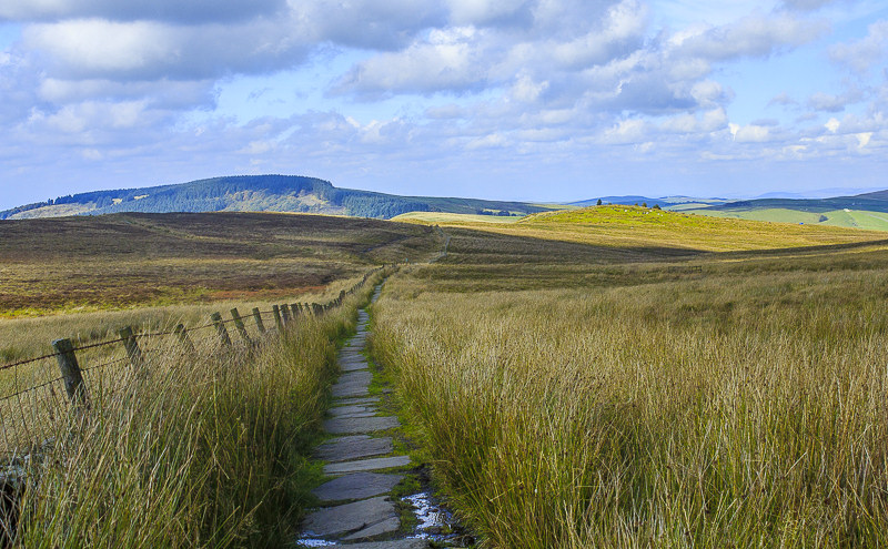
A flagged path makes crossing the moor painless.

It is a steep drop of Shutlingsloe with a path that was clearly put together by a giant as twice the drop between steps was so high I needed to sit on the step, one of the disadvantages of being so small.

As I approach Macclesfield Forest Tegg's Nose can be seen beyond the forest.

Following the path to the Standing Stone car park was very pleasant as for much of the way the trees have been felled so I had views across the forest.

From Standing Stone car park I could make out my route back which would follow the track below Cuckoo Rocks.

I also had a good view of the Tors from here.
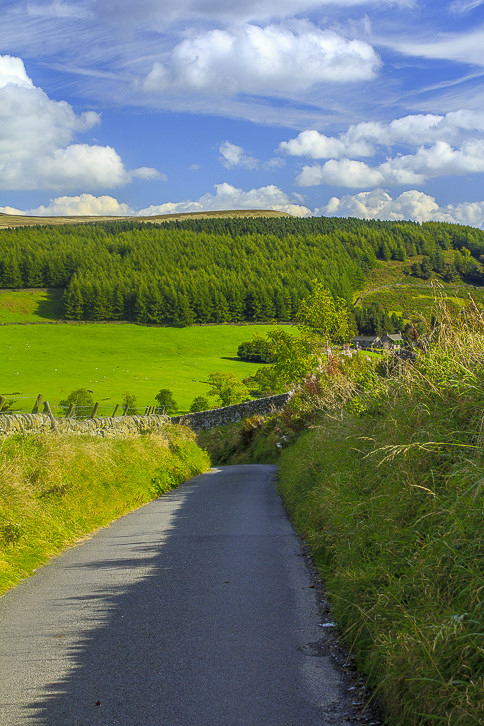
Before I began the new route I had to drop steeply down this quiet lane.

I followed the well signed track to Broughsplace.

Looking back towards Shutlingsloe from just above Broughsplace.

As I approached Torgate Farm I could make out a lone hang glider taking off from the side of the Tors.

Looking back towards Torgate Farm from Chest Hollow. It was really easy to follow the route thanks to the well placed stakes and signs, much better than getting lost and trespassing on someone's land.

The road signs on the left are a clear indication of how much climbing I still have to do, but this route makes it a gradual ascent.

Having crossed the A537 I get a final view of Shutlingsloe and Croker Hill before I reach the car. Sadly the Cat & Fiddle is still closed so no chance of a drink.
All pictures copyright © Peak Walker 2006-2023